
[Bacon (George Washington)]
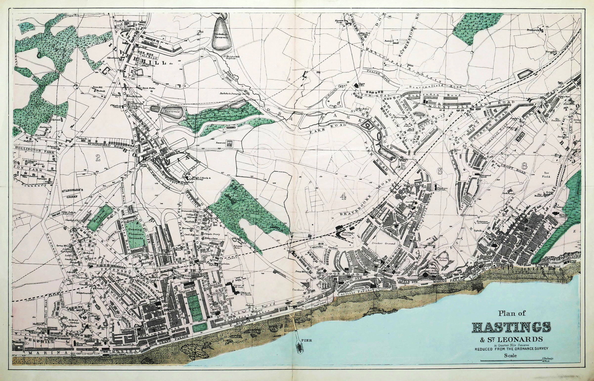
Plan of Hastings & St Leonards in Quarter Mile Squares,
[c.1885].
Sold. Contact us if you would like notifications on this or similar items in the future, or if you have a similar artwork you would like to sell.
reduced from the Ordnance Survey, showing the Victorian seaside resort and active fishing centre, after the opening of Hastings Pier in 1872, but before the last abortive attempt to build a proper walled harbour, with the subsequent transformation of the shoreline, which began in 1896, and the opening of St Leonards Pier in 1891,
lithographed map with original hand-colouring, 305 x 485 mm. (12 x 19 1/8 in), slight splitting at head and foot of the central vertical fold, a faint horizontal fold, a few marginal tears and surface dirt,
Related products

£240

Out of stock

Out of stock