


Betts (John)
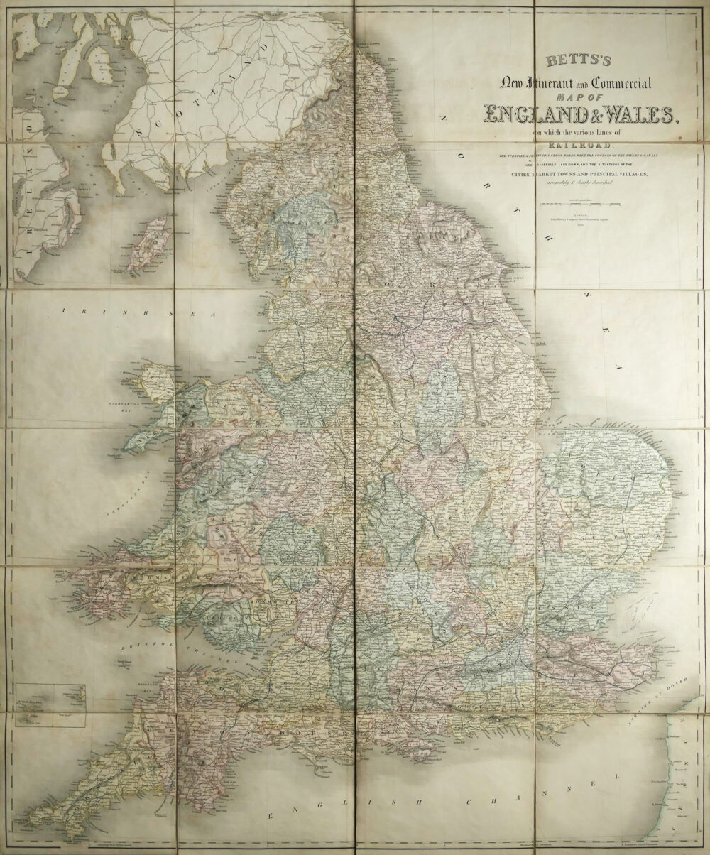
Betts's New Itinerant and Commercial Map of England and Wales,
£75
1838.
In stock
the earliest recorded edition of this highly detailed map that I have found, showing the burgeoning railway system at the start of Queen Victoria’s reign. The title in the upper right corner continues ‘on which the various lines of Railroad, the turnpike and principal cross roads, with the courses of the rivers and canals are carefully laid down, and the situation of Cities, Market Towns and Principal Villages accurately and clearly described’. In additiona to the extensive transport network, the map shows topographic relief, the counties are variously coloured and there is an inset of the Scilly Isles in the lower left corner. Southern Scotland and Northern Ireland and the north coast of France are shown in far less detail,
engraved map with original hand-colouring, 915 x 760 mm. (36 x 30 in), dissected and linen-backed, occasional faint spotting and toning, two of the publisher’s advertisements on the outer panels of the verso when folding into its original gilt-lettered, green cloth slipcase, this with some staining and the edges slightly worn, 4to,
Related products

British Maps
An Entire New Plan of the Cities of London & Westminster, with the Borough of Southwark, Comprehending the New Buildingsand other Alterations to the present time,

