


Cary (John)
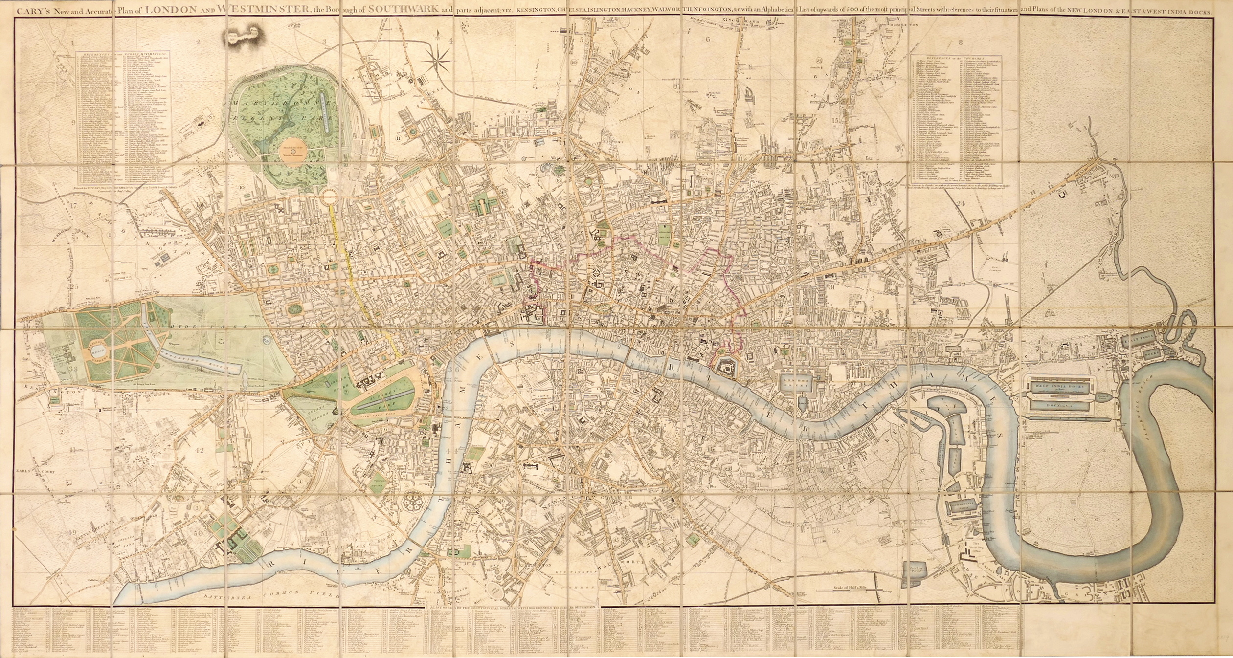
Cary's New and Accurate Plan of London and Westminster, the Borough of Southwark, and parts adjacent; viz. Kensington, Chelsea, Islington, Hackney, Walworth, Newington &c. with an Alphabetical list of upwards of 500 of the most principal Streets with references to their Situation and Plans 0f the New London & East & West India Docks,
1819.
Sold. Contact us if you would like notifications on this or similar items in the future, or if you have a similar artwork you would like to sell.
highly detailed, and highly regarded, plan of London, first issued in 1787, and which includes the eastern ‘docklands’ extension added from 1811, but not always present in subsequent editions. It extends from Canonbury to the Oval, and from Kensington to the River Lea and East India Dock. The long title spans the top of the map, with the lengthy index of streets in columns below the width of the original map, the lower margin of the eastern extension remaining blank. There are also two inset text panels listing public buildings, upper left, and churches, upper right,
engraved map with original hand-colouring, 815 x 1530 mm. (32 1/8 x 60 1/4 in), dissected and linen-backed, pale even browning, folding into its original green-marbled slipcase, worn, publisher’s title label pasted on, [Howgego 184 (16)],
Related products

Christmas 2022
De Cust van Barbaryen van out Mamora tot Capo Blanco, [on sheet with] De Cust van Barbaryen van Capo Blanco Tot Capo de Geer,

British Maps
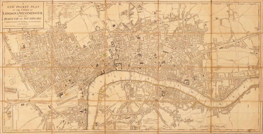
A New Pocket Plan of the Cities of London & Westminster, with the Borough of Southwark, Comprehending the New Buildings and other Alterations to the Year 1797,