


Davies (Benjamin Rees)
Davies's New Map of the British Metropolis,
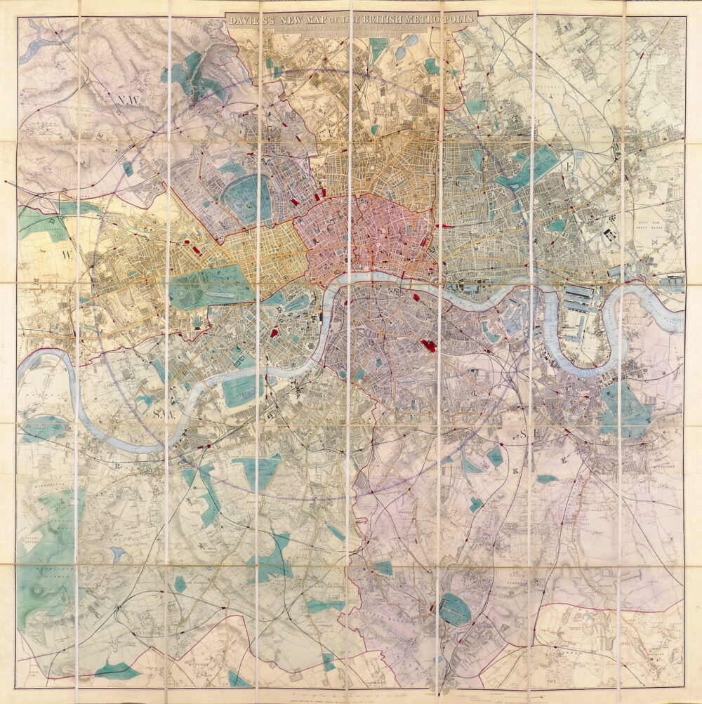
Davies’s New Map of the British Metropolis, the Boundaries of the Boroughs, County Court Districts, Railways, and Modern Improvements,
London, Edward Stanford, 1875.
an attractive example of the amended version of this map, first issued in 1854 to incorporate the newly opened Crystal Palace in Sydenham with a southern extension to Mitcham Common and South Norwood, from the original 1852 version’s limit of Clapham Common. The other compass point extremities remain Highgate, Chiswick and Plaistow, and the map retains the circle of 4 miles radius from Charing Cross and the half-mile interval markers from London Bridge along the Thames. This later update includes Liverpool Street station for the first time, and the publisher’s new address at 55 Charing Cross,.
Sold. Contact us if you would like notifications on this or similar items in the future, or if you have a similar artwork you would like to sell.
engraved map with full original hand-colouring, on 2 sheets, joined, dissected and linen-backed, occasional very light surface dust, one or two very minor marginal creases, generally in good condition, folding into publisher’s blind-embossed purple cloth, some sunning, particularly to spine, front cover gilt-lettered ‘Davies’ Map of the British Metropolis with the Extension to the Crystal Palace, yellow advertisement panels for Stanford’s Series of New Library Maps pasted inside the front cover and to the facing linen panel of the folded map, [Hyde 27 B. (12)],
| Dimensions | 9609403737 cm |
|---|
Related products
British Maps
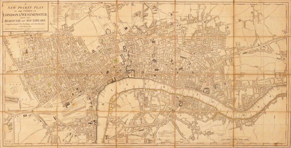
A New Pocket Plan of the Cities of London & Westminster, with the Borough of Southwark, Comprehending the New Buildings and other Alterations to the Year 1797,
British Maps
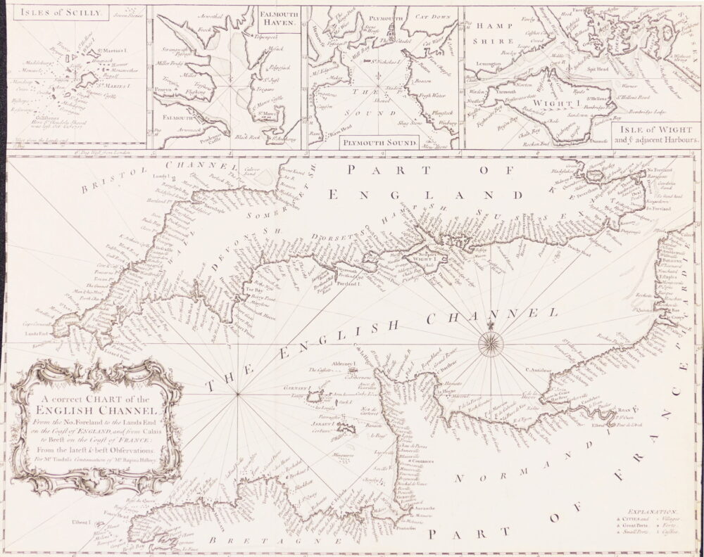
A Correct Chart of the English Channel from the No. Foreland to the Land's End on the Coast of England, and from Calais to Brest on the Coast of France,

British Maps
Bowles's New Pocket Plan of the Cities of London & Westminster with the Borough of Southwark,