Price (Charles)
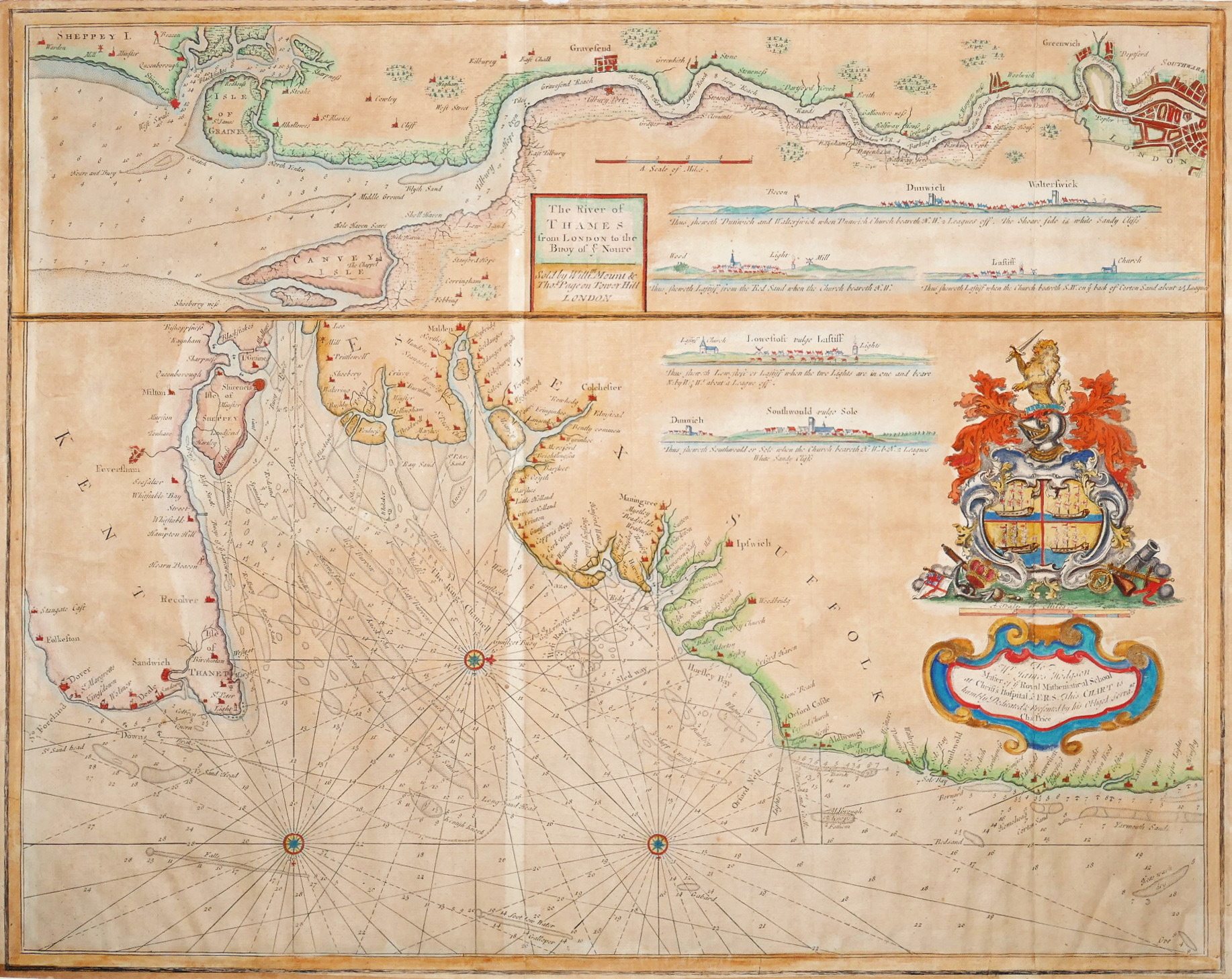
The River of Thames from London to the Buoy of ye Noure,
William Mount and Thomas Page, [c.1695].
Sold. Contact us if you would like notifications on this or similar items in the future, or if you have a similar artwork you would like to sell.
detailed 2-part chart, the larger part of the mouth of the Thames Estuary and adjacent coastline from Folkestone to Yarmouth, north oriented to the right, with two inset coastal recognition views of Lowestoft ‘vulgo Lastiff’ and Southwold, large coat-of-arms and dedication cartouche, upper right, compass roses and rhum lines, with a strip chart, above, of the Thames from London to the Isle of Sheppey, north oriented to the bottom, with inset coastal recognition views of Dunwich to Walterswick (Walberswick), and 2 of Lastiff (Lowestoft) if viewed from Red Sand or Corton Sand, a plain title panel,
engraved chart with old wash hand-colouring, 470 x 590 mm. (18 1/2 x 23 1/4 in), two faint old vertical folds with slight uneven browning to one, a short repaired split to the other, lower sheet edge slightly unevenly trimmed, occasionally just shaving the borderline, remargined and retouched as required in pen facsimile,
Related products
British Maps
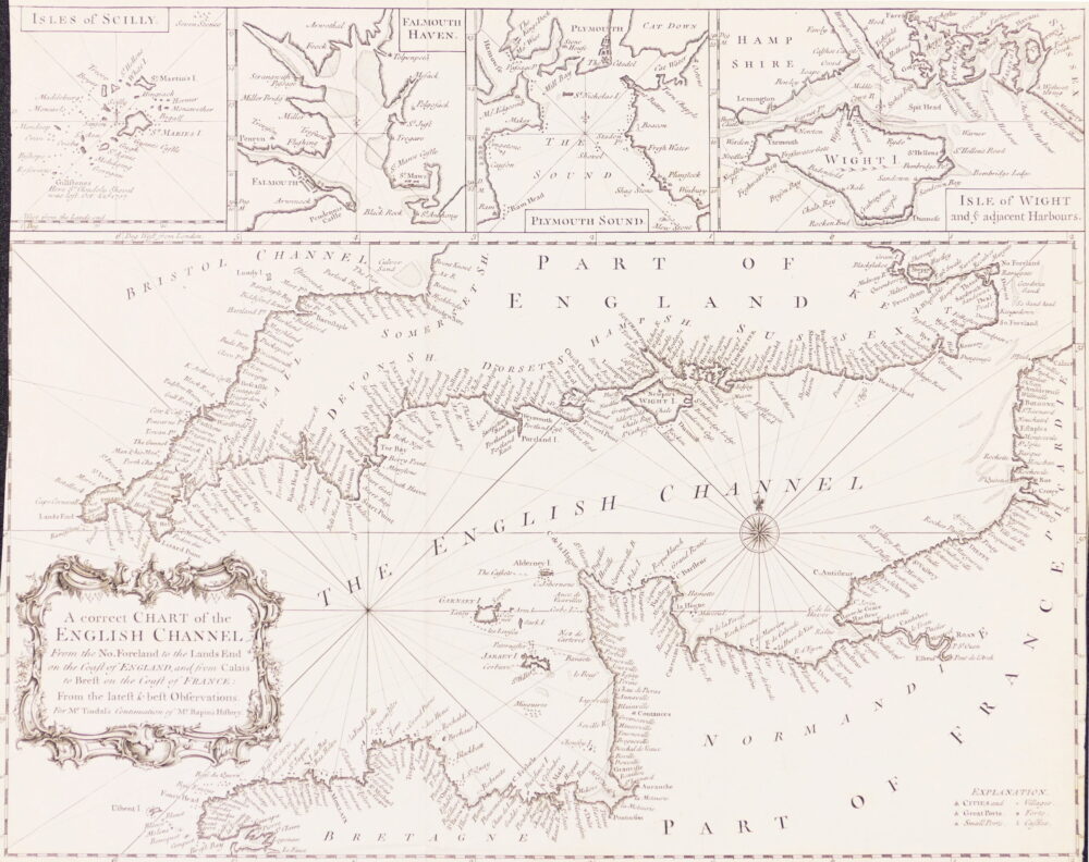
A Correct Chart of the English Channel from the No. Foreland to the Land's End on the Coast of England, and from Calais to Brest on the Coast of France,