


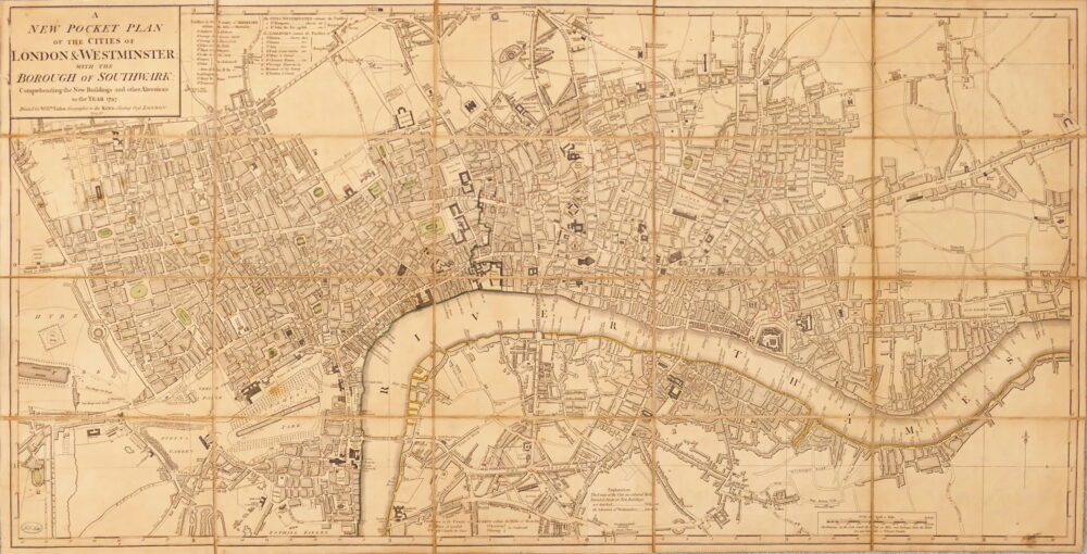
Wallis (John)
Wallis's Plan of the Cities of London and Westminster, 1799,
£600
London, John Wallis, 1799.
third annual update of this plan of Georgian London, first issued in 1797, extending from Pentonville to St George’s Fields, and from Hyde Park to Stepney, the title cartouche upper left and a panel containing New Hackney-Coach Fares, and Explanation, lower right,.
engraved map with original hand-colouring, dissected and linen-backed with some splitting along several folds, pale even browning, the names of Bartletts, Boswell, Crawshaw, Hobson and Palmer inscribed on verso in a contemporary or early hand, one panel in particular, [Howgego 214 (3)],
| Dimensions | 4308701734 cm |
|---|
Related products

British Maps
Cary's New and Accurate Plan of London and Westminster, the Borough of Southwark, and parts adjacent; viz. Kensington, Chelsea, Islington, Hackney, Walworth, Newington &c. with an Alphabetical list of upwards of 500 of the most principal Streets with references to their Situation and Plans 0f the New London & East & West India Docks,

British Maps
A New Pocket Plan of the Cities of London & Westminster, with the Borough of Southwark, Comprehending the New Buildings and other Alterations to the Year 1797,