
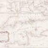

Goos (Pieter)
De Cust van Barbaryen van out Mamora tot Capo Blanco, [on sheet with] De Cust van Barbaryen van Capo Blanco Tot Capo de Geer,
£750
Amsterdam, (c.1666).
In stock
two horizontal strip charts of the coast of Morocco, with four smaller charts below comprising a detail of Faial Island inset within a coastal chart of São Miguel Island, lower left, a plan of Angra on Terceira Island, lower centre, all in the Azores, along with a chart of Madeira and Porto Santo, lower right, from a deluxe edition of the ‘Zee-Atlas ofte Water Werelde’, with gilt borders between the charts, and highlights to the compass roses and title cartouches that embellish each chart,
engraved chart with original hand-colouring, heightened with gold, 440 x 535 mm. (17 1/4 x 21 1/8 in), a central vertical fold,
Related products

British Maps
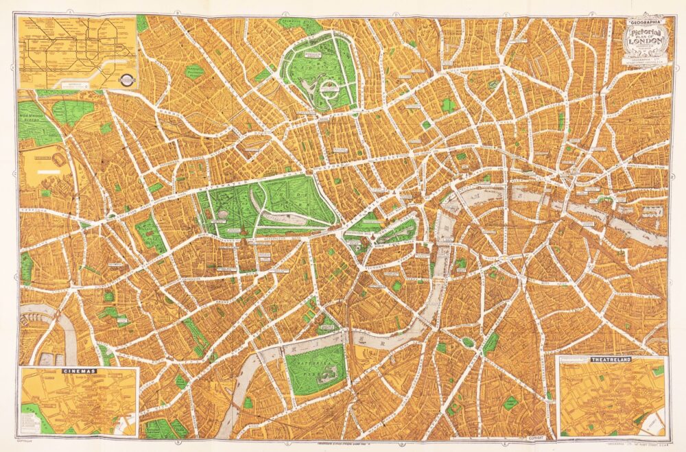
Cary's New and Accurate Plan of London and Westminster, the Borough of Southwark, and parts adjacent; viz. Kensington, Chelsea, Islington, Hackney, Walworth, Newington &c. with an Alphabetical list of upwards of 500 of the most principal Streets with references to their Situation and Plans 0f the New London & East & West India Docks,

British Maps
Greenwood (Christopher and John)
Map of the County of Cornwall from an Actual Survey made in the Years 1826 & 1827,