Skip to content
  • Pictures Specialist: Valuations | Cataloguing | Research | Auction Advice
  • Blog
  • About
  • Contact
  • Pictures Specialist: Valuations | Cataloguing | Research | Auction Advice
Robert Hall

Prints, Maps, Drawings & Watercolours

  • Home
  • Browse
  • Categories
    • Travel
    • British Topography
    • Natural History
    • Art & Architecture
    • Transport & Engineering
    • Caricatures
    • Drawings & Watercolours
    • Old Master Prints
    • Modern and Contemporary Art
    • Maps & Atlases
      • British Maps
      • Foreign Maps
  • Login
  • Basket / £0
    • No products in the basket.

  • Basket

    No products in the basket.

Gallery / Maps & Atlases / British Maps
Add to Wishlist

Geographia Ltd. (Publisher)

Pictorial Plan of London,

£60

(c.1940).

In stock

SKU: RC004 Categories: British Maps, Etsy 2022, Maps & Atlases, Transport & Engineering Tags: Cinema, City Plans, London, PBFA Travel Maps, Theatre, Transport
Categories
  • Art and Architecture
  • British Topography
    • London
    • Panoramas - British
    • Sussex
  • Caricatures
    • Portraits
  • Christmas 2022
  • Drawings & Watercolours
  • Etsy 2022
  • Maps & Atlases
    • British Maps
    • Foreign Maps
  • Modern and Contemporary Art
    • Etching Revival
  • Natural History
  • Old Master Prints
  • Photographs & Photographic Art
    • Space Exploration
  • Sports & Pastimes
  • The Paintings of Christopher Hall
  • Transport & Engineering
  • Travel
    • Panoramas - Foreign
  • Uncategorised
Keywords
Agriculture Animals Antique Prints of Italy Astronomy British Maps Caricature caricatures Celestial christmas20 Church Architecture City Plans City Views Classical Architecture Classical Mythology Costume County Maps Engineering English Architecture Etsy22 Exploration Geology Hastings Italian Architecture Italian Art Italy Lancashire Livestock London Military Modern Art Napoleonica NASA Photographs PBFA523 PBFA Feb Travel Politics Portraits Railways Rome Satire Scotland Social History Sussex Theatre Transport Yorkshire
  • Description

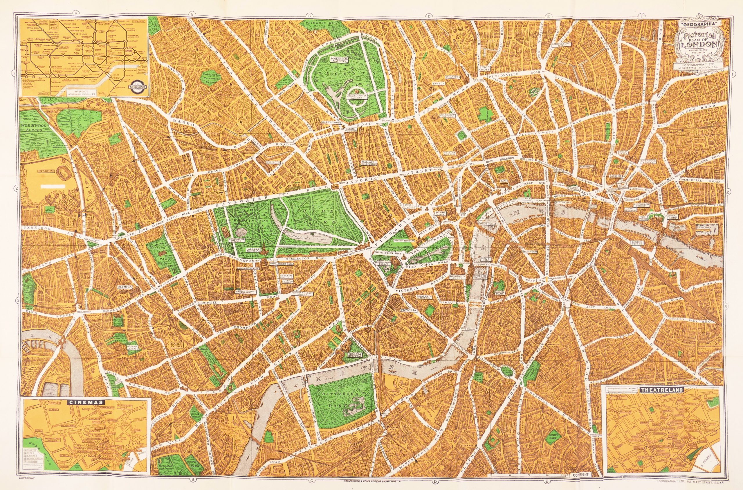
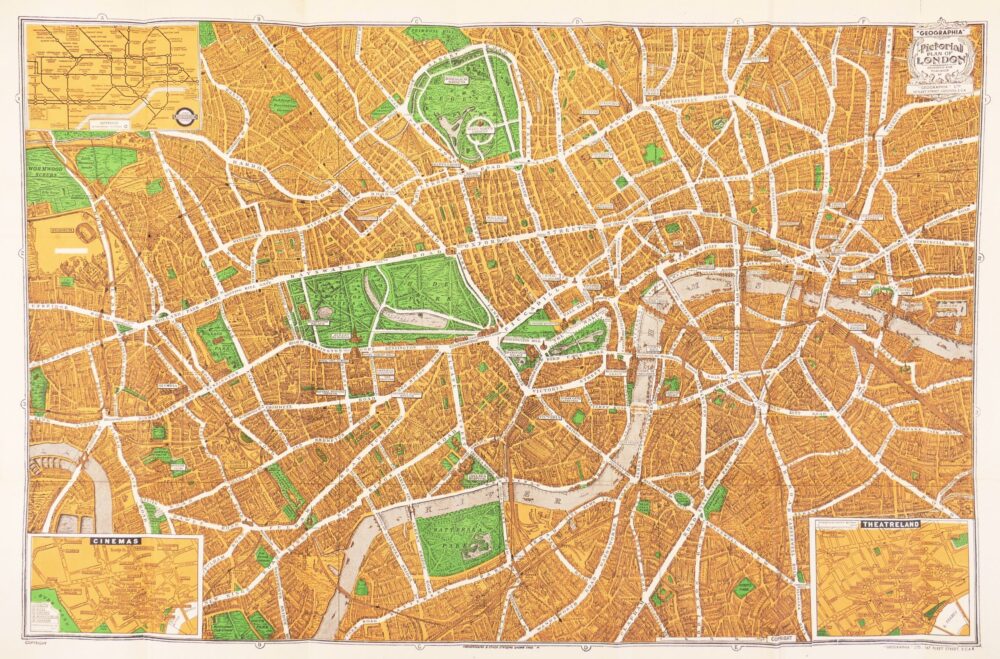
bird’s-eye, folding, pocket plan of London, extending from Primrose Hill to Wandsworth and from Ravenscourt Park in Hammersmith to London Docks, with stylised buildings, trees in parks and gardens, railways and viaducts, the more prominent public buildings enlarged and labelled, and the major roads picked out in white and named. The title cartouche is in the upper right corner, and an inset plan of the Underground in the upper, while the lower right corner displays an inset plan of Theatreland, predominently Soho, Charing Cross and St James’s. But it’s the inset plan of Cinemas, in the lower left corner, that is particularly redolent of the era, upon which the Second World War’s physical impact on London was to take such a toll, decades before the social and technological changes more usually associated with the demise of this hugely important form of entertainment. Amongst the numerous, and so diverse, names are the Polytechnic in Upper Regent Street, originally the theatre of the Royal Polythechnic Institute, which became the birthplace of cinema in the UK when the Lumière brothers demonstrated their ‘Cinematographe’ in 1896, but changed it’s named after a brief wartime closure and transfer of ownership to Cameo theatres in 1940; the Stoll in Kingsway, first opened by the German-American impresario, Oscar Hammerstein I, as the London Opera House in 1911, but taken over by Oswald Stoll and operated as a cinema from 1917 to 1940; the Bloomsbury Super in Theobolds Road, which also ran from 1921 to 1940; and many others of varied longevity, but all now long gone, such as the Monseigneur on Piccadilly, the Sphere on Tottenham Court Road, and the Marble Arch Pavilion,

colour-printed plan in orange and green, 470 x 725 mm. (18 1/2 x 28 1/2 in), one or two repaired splits on old folds, folding into the original printed limp orange covers, with the publisher’s address at 167 Fleet Street, edges rather frayed, 8vo, 

Related products

Add to Wishlist
Out of stock

British Maps

Davies (Benjamin Rees)

Map of Sussex, Part I, East,

Add to Wishlist

British Maps

Cary (John)

Cary's New Pocket Plan of London, Westminster and Southwark,

£600
Add to Wishlist

British Maps

Cary (John)

Cary's New and Accurate Plan of London and Westminster, the Borough of Southwark, and parts adjacent; viz. Kensington, Chelsea, Islington, Hackney, Walworth, Newington &c. with an Alphabetical list of upwards of 500 of the most principal Streets with references to their Situation and Plans 0f the New London & East & West India Docks,

£4,500
About

Specialising in antique prints, maps, atlases, plate books, drawings and watercolours, with a penchant for caricatures, Old Master prints and etching revival.

Terms & Conditions

Latest News
  • 23
    Jun
    Sir Giles Gilbert Scott OM, FRIBA (1880-1960) Comments Off on Sir Giles Gilbert Scott OM, FRIBA (1880-1960)
  • 26
    Apr
    Not just penal reform Comments Off on Not just penal reform
  • 14
    Feb
    Valentine’s Day 2020 Comments Off on Valentine’s Day 2020
  • 19
    Nov
    NASA Photography | Apollo 12 Moon Landing #OTD Comments Off on NASA Photography | Apollo 12 Moon Landing #OTD
Tags
Agriculture Animals Antique Prints of Italy Astronomy British Maps Caricature caricatures Celestial christmas20 Church Architecture City Plans City Views Classical Architecture Classical Mythology Costume County Maps Engineering English Architecture Etsy22 Exploration Geology Hastings Italian Architecture Italian Art Italy Lancashire Livestock London Military Modern Art Napoleonica NASA Photographs PBFA523 PBFA Feb Travel Politics Portraits Railways Rome Satire Scotland Social History Sussex Theatre Transport Yorkshire
Newsletter

Copyright 2023 © ROBERT HALL | PAINTINGS, PRINTS, MAPS, DRAWINGS & WATERCOLOURS | LONDON
  • Home
  • Browse
    • Categories
      • Travel
      • British Topography
      • Natural History
      • Art & Architecture
      • Transport & Engineering
      • Sports & Pastimes
      • Caricatures
      • Drawings & Watercolours
      • Old Master Prints
      • Modern and Contemporary Art
      • Maps & Atlases
        • British Maps
        • Foreign Maps
  • Blog
  • Contact
  • About
  • Terms & Conditions
  • Login

Login

Lost your password?