


Jansson (Jan)
Principatus Walliæ pars borealis, vulgo North Wales,
£250
Amsterdam, Pieter Schenk & Gerard Valk, c.1710.
Jansson’s map of North Wales, first issued in the mid-17th century, bearing the arms of Owain Glyndwr and those of the Prince of Wales in the upper right corner, the decorative title cartouche supported by puttin in the lower right corner, balanced by a scale cartouche lower left, with a compass rose, rhum lines and two galleons in the Irish Sea, Merionethshire and the principal towns solidly coloured, the remaining counties, including the adjoining English ones of Cheshire, Shropshire and Herefordshire, coloured in outline,.
engraved map with original hand-colouring, a central vertical fold, slight oxidisation of green pigment, a little spotting in the sea area,
| Dimensions | 4055101620 cm |
|---|
Related products

British Maps
Bowles's New Pocket Plan of the Cities of London & Westminster with the Borough of Southwark,
British Maps
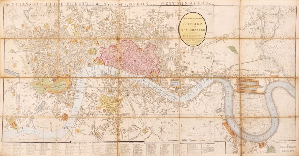
The Stranger's Guide Through the Streets of London and Westminster &c.,