

Speed (John)
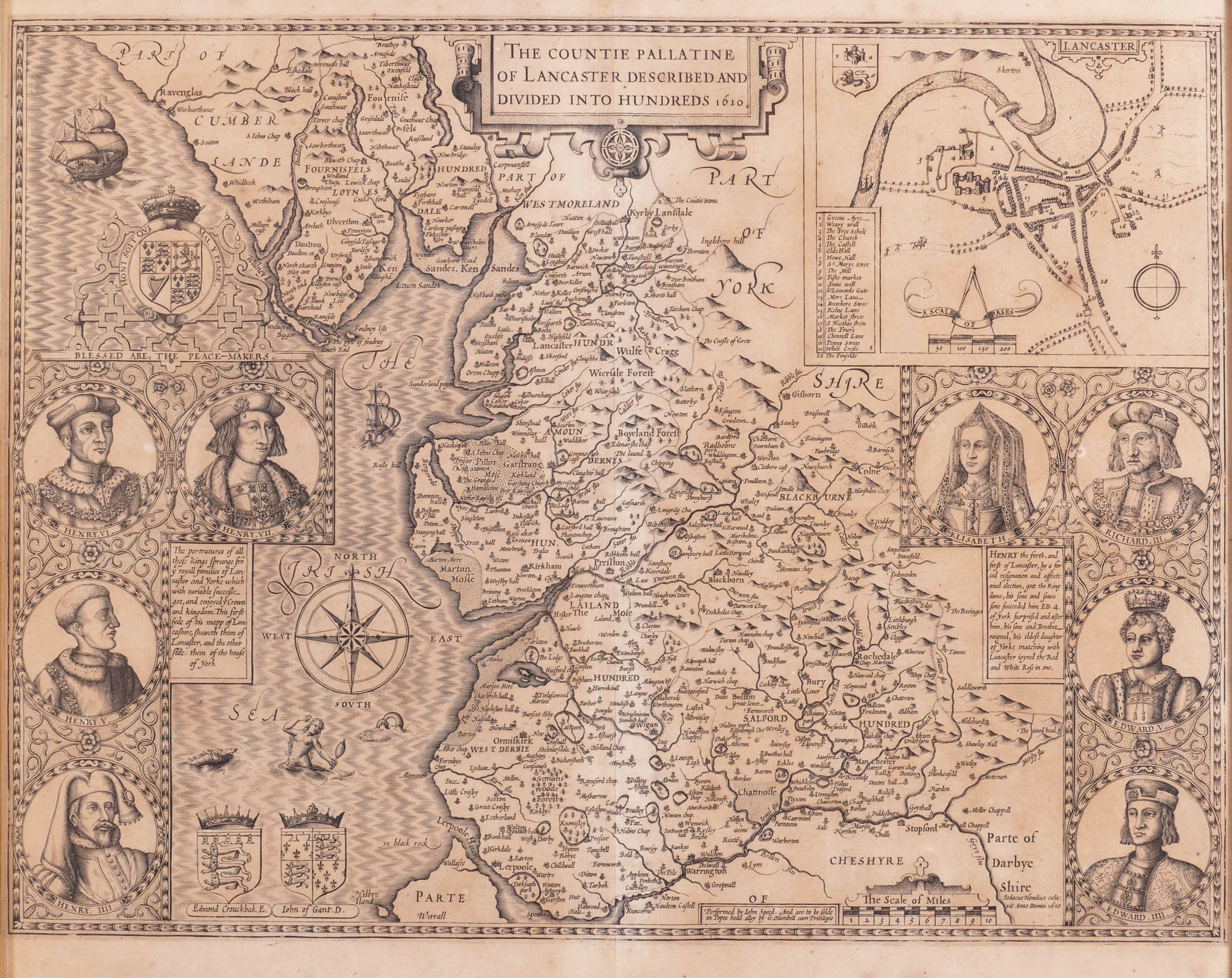
The Countie Pallatine of Lancaster Described and Divided into Hundreds,
George Humble, [1611].
Sold. Contact us if you would like notifications on this or similar items in the future, or if you have a similar artwork you would like to sell.
first edition, uncoloured as issued, one of only 11 county maps to carry the imprint of George Humble alone, county map of Lancashire showing parts of Cumberland, Westmorland, Yorkshire, Derbyshire and Cheshire, with an inset plan of Lancaster upper right, a strapwork title cartouche upper centre, and eight portrait medallions of sovereigns from the houses of Lancaster and York below, those of Henry IIII to Henry VII of Lancaster to the left, this group surmounted by the royal coat-of-arms, and those of Edward IIII, Edward V, Richard III and Elizabeth of York to the right, a compass rose, two galleons, a sea monster and a mermaid all in the Irish Sea, along with the armorial shields of Edmond Crouchback and John of Gaunt,
engraved map by Jodocus Hondius of Amsterdam, 385 x 510 mm. (15 1/8 x 20 in), English text on verso with the woodcut initial of William Hall and John Beale for the first edition, central vertical fold, pale even browning,
Related products


