
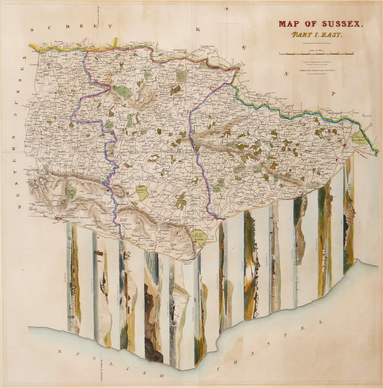


Davies (Benjamin Rees)
Map of Sussex, Part I, East,
Lewes, J. Baxter, 1834
Sold. Contact us if you would like notifications on this or similar items in the future, or if you have a similar artwork you would like to sell.
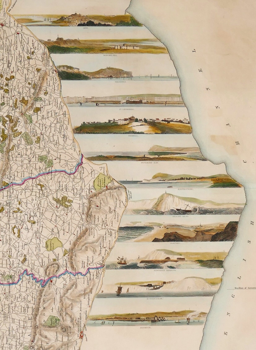
unusual and attractive county map incorporating 12 panoramas of seaside towns and features, inset perpendicular to the coast, showing Rye, Winchelsea, Hastings, St Leonard’s, Bexhill, Pevensey Bay, Eastbourne, Beachy Head, Seaford, Newhaven Harbour, Rottingdean and Brighton,
engraved map with hand-colouring, 430 x 420mm. (17 x 16 1/2 in), central vertical fold, slight splitting at ends of a horizontal fold, slight creasing and browning, hinged into mount,
Related products

British Maps
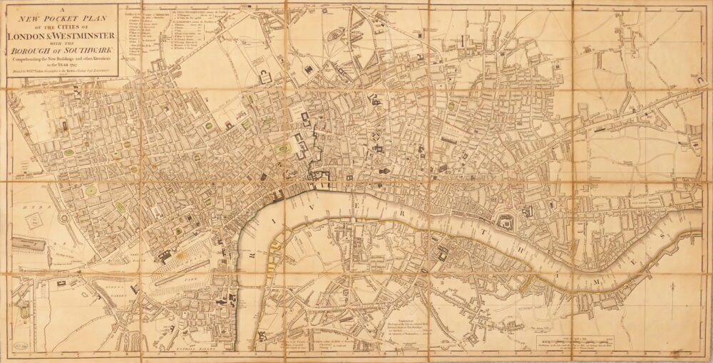
A New Pocket Plan of the Cities of London & Westminster, with the Borough of Southwark, Comprehending the New Buildings and other Alterations to the Year 1797,